Georiski and HPP: a new model for assessing threats to the Charvak reservoir
A group of researchers from the Academy of Sciences of Uzbekistan and leading universities of the country has developed a comprehensive model for assessing geological risks for the Charvak reservoir basin. This territory is a strategically important object for the economy of the region, combining the functions of a popular tourist zone and a key hub of hydropower. The results of the study, published in the international scientific publication The Egyptian Journal of Remote Sensing and Space Sciences, indicate a high probability of landslides and other dangerous slope processes that can threaten both civil and energy infrastructure.
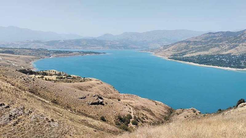
The Charvak reservoir, located in the western part of the Tien Shan, is located in the zone of active tectonic faults. In addition to recreational significance, the reservoir plays a critical role in irrigation and power generation. A feature of the operation of the waterworks is the seasonal fluctuation of the water level: the accumulation of resources occurs until July due to snowmelt, and from August to October intensive discharge is carried out for the needs of agriculture and energy generation. Scientists have found that such hydrological cycles create an additional load on the coastal slopes, changing the pore pressure in the soil and provoking instability of rocks.
To create a map of the vulnerability of the territory, specialists applied the methods of remote sensing of the Earth and geoinformation modeling (GIS). The analysis was based on data from Landsat satellites and SRTM radar topography. The model took into account six key factors: slope steepness, lithological composition of rocks, density of tectonic disturbances (lineaments), soil moisture index (NDWI), as well as the remoteness of objects from active faults and the shoreline of the reservoir. The use of satellite imagery has made it possible to compensate for the lack of ground-based data in hard-to-reach mountainous areas.
The analysis showed that about 19% of the basin area belongs to the categories of high and very high risk. These zones are characterized by steep slopes (more than 25 degrees), weak soils and high humidity. Of particular concern is the fact that dangerous areas significantly intersect with the existing infrastructure. 27% of the region’s road network, as well as 21% of settlements and tourist sites are located in areas of increased vulnerability. The study confirmed a direct correlation between the mode of operation of hydraulic structures and the activation of geodynamic processes: fluctuations in the water level in the reservoir contribute to the redistribution of stresses in the coastal massif, which increases the risk of collapses.
The paper notes that until now there have been no integrated georisk maps for the Charvak basin that take into account the totality of all factors. Previous research was often fragmented. The new model, using the hierarchy analysis method (AHP), revealed that the dominant factors of instability are the slope of the terrain and tectonic fragmentation. At the same time, the areas of high humidity identified by spectral analysis often coincide with the sites of historical landslides and seismic activity provoked by filling the reservoir.
The data obtained are of practical importance for planning the development of the territory and ensuring the safety of hydropower facilities. The authors of the study emphasize the need for strict regulation of land use in the identified risk areas. For hydropower, the simulation results are important from the point of view of predicting the state of the coastline and preventing situations where the collapse of large soil masses may affect the operation of spillways and dams. Scientists recommend implementing a system of continuous monitoring of deformations of the earth’s surface using GNSS technologies and detailed field studies to clarify the boundaries of hazardous areas.
The developed approach demonstrates the effectiveness of a combination of satellite data and multi-criteria analysis for assessing threats in mountainous areas with a limited set of ground-based observations. In the conditions of expanding infrastructure and climatic changes affecting the water regime, the availability of accurate maps of georisks becomes a prerequisite for trouble-free operation of hydraulic structures and sustainable development of the region as a whole.
Alexander Eskendirov (Rivers.Help!)
Original (in Russian): Геориски и ГЭС: новая модель оценки угроз для Чарвакского водохранилища